import rastereasy
Adjust size of two images
For some reasons, it could be interesting to have two images where pixels are perfectly aligned.
This can be done by extracting common areas (function extract_common_areas) or by extending the shapes for including both images (function extend_common_areas)
1) Extract common areas
help(rastereasy.extract_common_areas)
Help on function extract_common_areas in module rastereasy.rastereasy:

extract_common_areas(im1, im2, resolution='min', projection=None)
    Extract the overlapping area between two GeoImages.

    Parameters
    ----------
    im1 : Geoimage
        First input image
    im2 : Geoimage
        Second input image
    resolution : {'min', 'max', None}, optional
        How to handle resolution differences:
        - 'min': Use the more precise (smaller pixel size) resolution
        - 'max': Use the less precise (larger pixel size) resolution
        - None: Keep original resolutions
        Default is 'min'.
    projection : str, optional
        Projection system for output images. If None, uses im1's projection.
        Example: "EPSG:4326"
        Default is None.

    Returns
    -------
    Geoimage, Geoimage
        Two new Geoimages containing only the common overlapping area

    Examples
    --------
    >>> # Extract common area with smallest pixel size
    >>> common_im1, common_im2 = extract_common_areas(image1, image2)
    >>>
    >>> # Extract common area with specific projection
    >>> common_im1, common_im2 = extract_common_areas(image1, image2, projection="EPSG:4326")

    Notes
    -----
    This function is useful for preparing images for analysis or comparison when
    they cover different geographical areas but have an overlapping region.
Read images
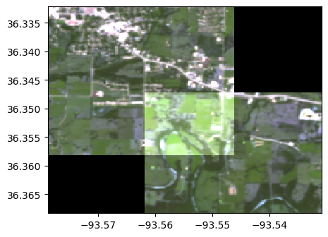
im1=rastereasy.Geoimage('./data/demo/RGB_common_2.tif')
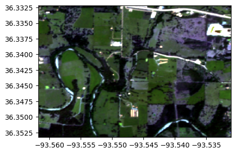
im2=rastereasy.Geoimage('./data/demo/RGB_common_1.tif')
im1.info()
im2.info()
im1.colorcomp()
im2.colorcomp()
- Size of the image:
   - Rows (height): 470
   - Cols (width): 550
   - Bands: 3
- Spatial resolution: 5.0  meters / degree (depending on projection system)
- Central point latitude - longitude coordinates: (36.34273470, -93.54640777)
- Driver: GTiff
- Data type: int16
- Projection system: EPSG:32615
- Nodata: -32768.0

- Given names for spectral bands:
   {'1': 1, '2': 2, '3': 3}


- Size of the image:
   - Rows (height): 145
   - Cols (width): 145
   - Bands: 3
- Spatial resolution: 20.068965517241377  meters / degree (depending on projection system)
- Central point latitude - longitude coordinates: (36.35530372, -93.56246171)
- Driver: GTiff
- Data type: int16
- Projection system: EPSG:32615
- Nodata: -32768.0

- Given names for spectral bands:
   {'1': 1, '2': 2, '3': 3}
<Figure size 640x480 with 0 Axes>
<Figure size 640x480 with 0 Axes>
Get common areas with lowest and highest spatial resolution
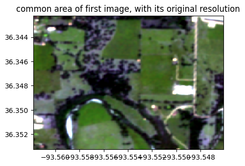
im1_common_res1, im2_common_res1 = rastereasy.extract_common_areas(im1, im2,resolution = None)
im1_common_res2, im2_common_res2 = rastereasy.extract_common_areas(im1, im2,resolution = 'max')
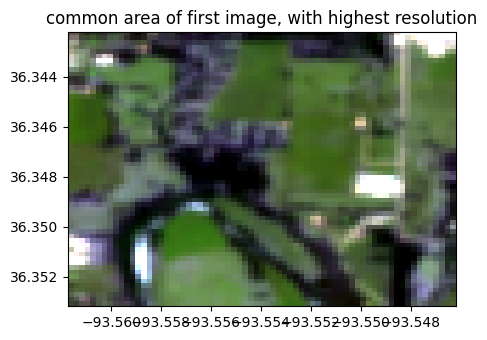
im1_common_res1.info()
im1_common_res1.colorcomp(title='common area of first image, with its original resolution')
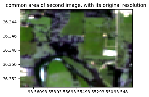
im2_common_res1.info()
im2_common_res1.colorcomp(title='common area of second image, with its original resolution')
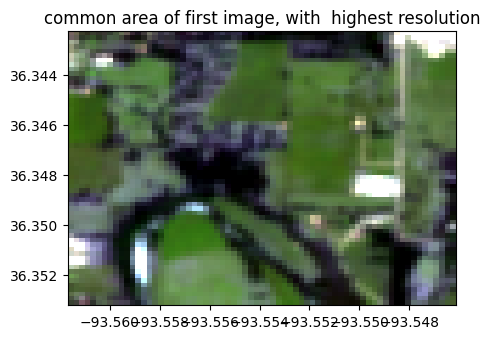
im1_common_res2.info()
im1_common_res2.colorcomp(title='common area of first image, with highest resolution')
im2_common_res2.info()
im2_common_res2.colorcomp(title='common area of first image, with highest resolution')
- Size of the image:
   - Rows (height): 246
   - Cols (width): 280
   - Bands: 3
- Spatial resolution: 5.0  meters / degree (depending on projection system)
- Central point latitude - longitude coordinates: (36.34774922, -93.55396373)
- Driver: GTiff
- Data type: int16
- Projection system: EPSG:32615
- Nodata: -32768.0

- Given names for spectral bands:
   {'1': 1, '2': 2, '3': 3}
<Figure size 640x480 with 0 Axes>
- Size of the image:
   - Rows (height): 61
   - Cols (width): 70
   - Bands: 3
- Spatial resolution: 20.068965517241377  meters / degree (depending on projection system)
- Central point latitude - longitude coordinates: (36.34774508, -93.55401807)
- Driver: GTiff
- Data type: int16
- Projection system: EPSG:32615
- Nodata: -32768.0

- Given names for spectral bands:
   {'1': 1, '2': 2, '3': 3}
<Figure size 640x480 with 0 Axes>
- Size of the image:
   - Rows (height): 61
   - Cols (width): 69
   - Bands: 3
- Spatial resolution: 20.072992700729927  meters / degree (depending on projection system)
- Central point latitude - longitude coordinates: (36.34770281, -93.55396278)
- Driver: GTiff
- Data type: int16
- Projection system: EPSG:32615
- Nodata: -32768.0

- Given names for spectral bands:
   {'1': 1, '2': 2, '3': 3}
<Figure size 640x480 with 0 Axes>
- Size of the image:
   - Rows (height): 61
   - Cols (width): 69
   - Bands: 3
- Spatial resolution: 20.068965517241377  meters / degree (depending on projection system)
- Central point latitude - longitude coordinates: (36.34774561, -93.55390624)
- Driver: GTiff
- Data type: int16
- Projection system: EPSG:32615
- Nodata: -32768.0

- Given names for spectral bands:
   {'1': 1, '2': 2, '3': 3}
<Figure size 640x480 with 0 Axes>
2) Extend common areas
help(rastereasy.extend_common_areas)
Help on function extend_common_areas in module rastereasy.rastereasy:

extend_common_areas(
    image1,
    image2,
    nodata_value=0,
    resolution='min',
    projection=None
)
    Extend two images to cover their combined area, filling new areas with nodata value.

    Parameters
    ----------
    image1 : Geoimage
        First input image
    image2 : Geoimage
        Second input image
    nodata_value : int or float, optional
        Value to use for areas outside the original image bounds.
        Default is 0.
    resolution : {'min', 'max'}, optional
        How to handle resolution differences:
        - 'min': Use the more precise (smaller pixel size) resolution
        - 'max': Use the less precise (larger pixel size) resolution
        Default is 'min'.
    projection : str, optional
        Projection to use for output images. If None, uses image1's projection.
        Default is None.

    Returns
    -------
    Geoimage, Geoimage
        Two new Geoimages, each covering the combined area of both input images

    Examples
    --------
    >>> extended_im1, extended_im2 = extend_common_areas(image1, image2)

    Notes
    -----
    This function is useful for preparing images with different extents for comparison
    or mathematical operations that require the same dimensions.
Get extended areas with lowest and highest spatial resolution
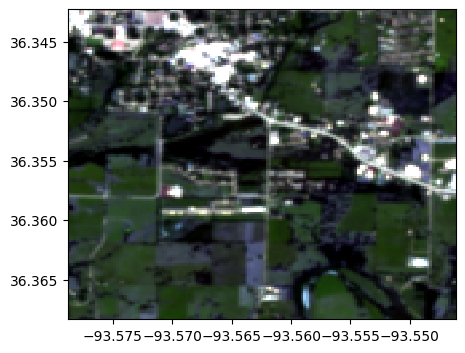
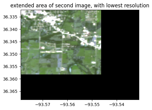
im1_extend_res1, im2_extend_res1 = rastereasy.extend_common_areas(im1, im2, resolution = 'min')
im1_extend_res2, im2_extend_res2 = rastereasy.extend_common_areas(im1, im2, resolution = 'max')
im1_extend_res1.info()
im1_extend_res1.colorcomp(title='extended area of first image, with lowest resolution')
im2_extend_res1.info()
im2_extend_res1.colorcomp(title='extended area of second image, with lowest resolution')
im1_extend_res2.info()
im1_extend_res2.colorcomp(title='extended area of first image, with highest resolution')
im2_extend_res2.info()
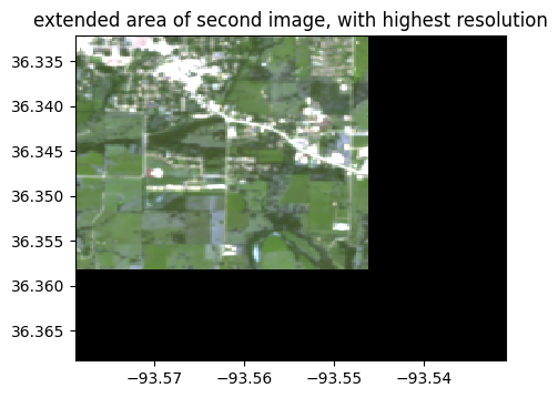
im2_extend_res2.colorcomp(title='extended area of second image, with highest resolution')
- Size of the image:
   - Rows (height): 808
   - Cols (width): 854
   - Bands: 3
- Spatial resolution: 5.0  meters / degree (depending on projection system)
- Central point latitude - longitude coordinates: (36.35031190, -93.55493418)
- Driver: GTiff
- Data type: int16
- Projection system: EPSG:32615
- Nodata: 0

- Given names for spectral bands:
   {'1': 1, '2': 2, '3': 3}
<Figure size 640x480 with 0 Axes>
- Size of the image:
   - Rows (height): 201
   - Cols (width): 212
   - Bands: 3
- Spatial resolution: 20.141509433962263  meters / degree (depending on projection system)
- Central point latitude - longitude coordinates: (36.35024423, -93.55484933)
- Driver: GTiff
- Data type: int16
- Projection system: EPSG:32615
- Nodata: 0

- Given names for spectral bands:
   {'1': 1, '2': 2, '3': 3}
<Figure size 640x480 with 0 Axes>
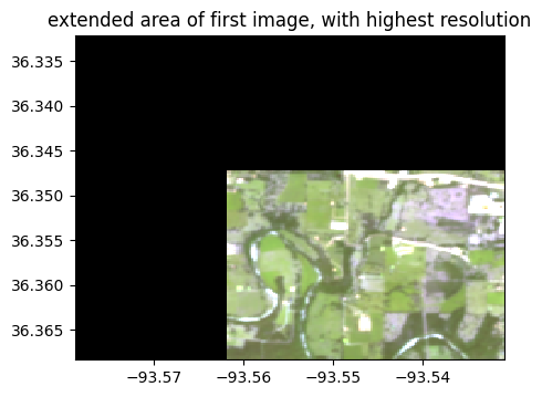
(0.5*(im1_extend_res2+im2_extend_res2)).colorcomp()
<Figure size 640x480 with 0 Axes>