import rastereasy
Stack images
Two options
Return a stacked image (function
stack)Stack directly the original image (function
stackwithinplace=True)
Example by stacking an original image with its clusterised version
1) Return a stacked image (function stack)
1) read an image
names = {"NIR":8,"G":3,"CO" : 1,"SWIR2":11,"B": 2,"R":4,"RE1":5,"RE2":6,"RE3":7,"WA":9,"SWIR1":10,"SWIR3":12}
im1=rastereasy.Geoimage('./data/demo/sentinel.tif',names=names,history=True)
help(im1.stack)
Help on method stack in module rastereasy.rastereasy:

stack(
    im_to_stack,
    dtype=None,
    dest_name=None,
    inplace=False,
    reformat_names=False
) method of rastereasy.rastereasy.Geoimage instance
    Stack bands from another image onto this image (in-place).

    This method combines the bands from another image with the current image,
    modifying the current image to include all bands from both sources.

    Parameters
    ----------
    im_to_stack : Geoimage
        The image whose bands will be stacked onto this image.
        Should have the same spatial dimensions (rows, cols).

    dtype : str or None, optional
        The data type for the stacked image. If None, an appropriate type is
        determined based on the types of both input images.
        Common values: 'float64', 'float32', 'int32', 'uint16', 'uint8'.
        Default is None.

    dest_name : str, optional
        Path to save the stacked image. If None, the image is not saved.
        Default is None.

    inplace : bool, default False
        If False, return a copy of the stacked image. Otherwise, do stacking in place and return None.

    reformat_names : bool, optional
        If True, band names will be reset to a simple numeric format ("1", "2", "3", ...).
        If False, the function will preserve original band names where possible,
        adding suffixes if needed to resolve conflicts.
        Default is False.

    Returns
    -------
    Geoimage
        The image with additional bands

    Raises
    ------
    ValueError
        If the spatial dimensions of the images don't match or an unknown dtype is specified.

    Examples
    --------
    >>> # Stack two images with different spectral bands
    >>> optical = Geoimage("optical.tif", names={'R': 1, 'G': 2, 'B': 3})
    >>> thermal = Geoimage("thermal.tif", names={'T': 1})
    >>> combined = optical.stack(thermal)
    >>> print(f"Combined bands: {list(combined.names.keys())}")
    >>>
    >>> # Stack and rename bands sequentially
    >>> combined = optical.stack(thermal, reformat_names=True)
    >>> print(f"After renaming: {list(combined.names.keys())}")
    >>>
    >>> # Stack with explicit data type
    >>> combined = optical.stack(thermal, dtype='float32', dest_name='combined.tif')
    >>>
    >>> # Stack in the image directly
    >>> optical.stack(thermal, reformat_names=True, inplace=True)
    >>> print(f"After renaming: {list(combined.names.keys())}")

    Notes
    -----
    - The bands from both images are combined along the band dimension (axis 0).
    - Band naming conflicts are resolved automatically, adding suffixes if needed.
    - The spatial dimensions (rows, cols) of both images must match.
2) computing a clustering (for the example)
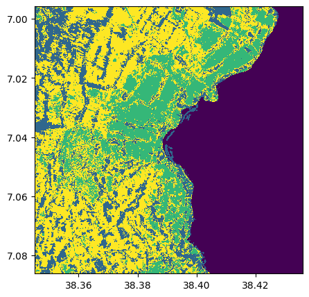
im_clust,_ = im1.kmeans(4)
im_clust.visu()
<Figure size 640x480 with 0 Axes>
3) Stack the two images with stack
im_stacked=im1.stack(im_clust)
im_stacked.info()
- Size of the image:
   - Rows (height): 1000
   - Cols (width): 1000
   - Bands: 13
- Spatial resolution: 10.0  meters / degree (depending on projection system)
- Central point latitude - longitude coordinates: (7.04099599, 38.39058840)
- Driver: GTiff
- Data type: int32
- Projection system: EPSG:32637
- Nodata: -32768.0

- Given names for spectral bands:
   {'CO': 1, 'B': 2, 'G': 3, 'R': 4, 'RE1': 5, 'RE2': 6, 'RE3': 7, 'NIR': 8, 'WA': 9, 'SWIR1': 10, 'SWIR2': 11, 'SWIR3': 12, '1': 13}
2) Stack directly the original image (function stack with inplace=True)
im1.info()
im1.stack(im_clust, inplace=True)
im1.info()
- Size of the image:
   - Rows (height): 1000
   - Cols (width): 1000
   - Bands: 12
- Spatial resolution: 10.0  meters / degree (depending on projection system)
- Central point latitude - longitude coordinates: (7.04099599, 38.39058840)
- Driver: GTiff
- Data type: int16
- Projection system: EPSG:32637
- Nodata: -32768.0

- Given names for spectral bands:
   {'CO': 1, 'B': 2, 'G': 3, 'R': 4, 'RE1': 5, 'RE2': 6, 'RE3': 7, 'NIR': 8, 'WA': 9, 'SWIR1': 10, 'SWIR2': 11, 'SWIR3': 12}

--- History of modifications---
[2025-06-04 15:30:31] - Read image ./data/demo/sentinel.tif


- Size of the image:
   - Rows (height): 1000
   - Cols (width): 1000
   - Bands: 13
- Spatial resolution: 10.0  meters / degree (depending on projection system)
- Central point latitude - longitude coordinates: (7.04099599, 38.39058840)
- Driver: GTiff
- Data type: int32
- Projection system: EPSG:32637
- Nodata: -32768.0

- Given names for spectral bands:
   {'CO': 1, 'B': 2, 'G': 3, 'R': 4, 'RE1': 5, 'RE2': 6, 'RE3': 7, 'NIR': 8, 'WA': 9, 'SWIR1': 10, 'SWIR2': 11, 'SWIR3': 12, '1': 13}

--- History of modifications---
[2025-06-04 15:30:31] - Read image ./data/demo/sentinel.tif
[2025-06-04 15:30:32] - Stacked 1 bands (1) onto existing 12 bands. Output type: int32. Band names were combined without modification (no conflicts).
Create Stack from files
You can use the rastereasy.files2stack function to stack different files
help(rastereasy.files2stack)
Help on function files2stack in module rastereasy.rastereasy:

files2stack(
    imagefile_path,
    resolution=None,
    names='origin',
    dest_name=None,
    ext='jp2',
    history=False
)
    Create a stacked Geoimage from multiple single-band images.

    This function creates a multi-band Geoimage by stacking individual images,
    either from a list of image paths or from all images in a directory.
    All input images should have 1 band each.

    Parameters
    ----------
    imagefile_path : str or list of str
        - If a list of strings: paths to image files to stack (e.g., ['image1.jp2', 'image2.jp2', ...])
        - If a string: path to a directory containing images with the specified extension
    resolution : float, optional
        Resolution to which all images will be resampled. If None, all images must
        have the same resolution already.
        Default is None.
    names : dict or str, optional
        How to name the spectral bands in the stack:
        - If a dict: Maps band names to indices (e.g., {'B': 1, 'G': 2, 'R': 3, ...})
        - If "origin" (default): Uses the original filenames as band names
        - If None: Assigns numeric names ('1', '2', '3', ...)
        Default is "origin".
    dest_name : str, optional
        Path to save the stacked image as a TIFF file.
        Default is None (no file saved).
    ext : str, optional
        File extension of images to load if imagefile_path is a directory.
        Default is 'jp2'.
    history : bool, optional
        Whether to enable history tracking for the output Geoimage.
        Default is False.

    Returns
    -------
    Geoimage
        A stacked Geoimage containing all the input images as bands.

    Examples
    --------
    >>> # Stack from a list of image files
    >>> list_images = ['band1.jp2', 'band2.jp2', 'band3.jp2']
    >>> stacked_image = files2stack(list_images)
    >>> stacked_image.save('stacked.tif')
    >>>
    >>> # Stack all jp2 files from a directory with resolution resampling
    >>> folder_path = './my_bands_folder'
    >>> stacked_image = files2stack(folder_path, resolution=10)
    >>> stacked_image.info()

    Notes
    -----
    This function is particularly useful for combining separate band files (common in
    satellite imagery) into a single multi-band image for analysis.
1) By specifying the list of files
list_tif=['./data/demo/tostack/G5_B2.tif','./data/demo/tostack/G5_B3.tif','./data/demo/tostack/G5_B4.tif','./data/demo/tostack/G5_B8.tif']
resolution=10

stack1=rastereasy.files2stack(list_tif,resolution=resolution)
stack1.info()
- Size of the image:
- Rows (height): 2370
- Cols (width): 3144
- Bands: 4
- Spatial resolution: 10.0 meters / degree (depending on projection system)
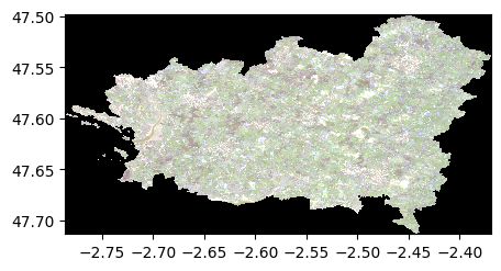
- Central point latitude - longitude coordinates: (47.60615500, -2.57780166)
- Driver: GTiff
- Data type: uint16
- Projection system: EPSG:32630
- Given names for spectral bands:
{'G5_B2': 1, 'G5_B3': 2, 'G5_B4': 3, 'G5_B8': 4}
2) By giving the folder and extension of contained files
rep='./data/demo/tostack/'
ext='tif'
stack2=rastereasy.files2stack(rep,ext=ext,dest_name='./data/results/stack/stack.tif',resolution=resolution)
stack2.info()
# Check the identify between stacked images
print('Differences between images : ', (stack2-stack1).abs().sum())
- Size of the image:
   - Rows (height): 2370
   - Cols (width): 3144
   - Bands: 4
- Spatial resolution: 10.0  meters / degree (depending on projection system)
- Central point latitude - longitude coordinates: (47.60615500, -2.57780166)
- Driver: GTiff
- Data type: uint16
- Projection system: EPSG:32630

- Given names for spectral bands:
   {'G5_B2': 1, 'G5_B3': 2, 'G5_B4': 3, 'G5_B8': 4}


Differences between images :  0
stack2.colorcomp()
<Figure size 640x480 with 0 Axes>