import rastereasy
name_im='./data/demo/sentinel.tif'
image=rastereasy.open(name_im)
Extract numpy arrays
1) Channel first format
im=image.numpy_channel_first()
print(im.shape)
(12, 1000, 1000)
### 2) Channel last format
im=image.numpy_channel_last()
print(im.shape)
(1000, 1000, 12)
Some channels in numpy array
a) If names are not given
bands=["1","4","3"]
im=image.numpy_channel_first(bands=bands)
print(im.shape)
bands=[1,4,3,8]
im=image.numpy_channel_last(bands=bands)
print(im.shape)
(3, 1000, 1000)
(1000, 1000, 4)
b) If names are given
# first : change the names of the image
names = {"NIR":8,"G":3,"CO" : 1,"SWIR2":11,"B": 2,"R":4,"RE1":5,"RE2":6,"RE3":7,"WA":9,"SWIR1":10,"SWIR3":12}
image.change_names(names)
image.info()
- Size of the image:
   - Rows (height): 1000
   - Cols (width): 1000
   - Bands: 12
- Spatial resolution: 10.0  meters / degree (depending on projection system)
- Central point latitude - longitude coordinates: (7.04099599, 38.39058840)
- Driver: GTiff
- Data type: int16
- Projection system: EPSG:32637
- Nodata: -32768.0

- Given names for spectral bands:
   {'CO': 1, 'B': 2, 'G': 3, 'R': 4, 'RE1': 5, 'RE2': 6, 'RE3': 7, 'NIR': 8, 'WA': 9, 'SWIR1': 10, 'SWIR2': 11, 'SWIR3': 12}
bands=["R","G","B"]
im=image.numpy_channel_first(bands=bands)
print(im.shape)
bands=["R","NIR","G","B"]
im=image.numpy_channel_last(bands=bands)
print(im.shape)
(3, 1000, 1000)
(1000, 1000, 4)
Entire image in table of size (row*col, bands)
help(image.numpy_table)
Help on method numpy_table in module rastereasy:

numpy_table(bands=None) method of rastereasy.Geoimage instance
    Extract image data as a 2D table of shape (pixels, bands).

    This method reshapes the image into a 2D table where each row represents a pixel
    and each column represents a band. This format is useful for machine learning,
    statistical analysis, or any operation that treats pixels as independent samples.

    Parameters
    ----------
    bands : str, list of str, or None, optional
        The bands to include in the output:
        - If None: Returns all bands
        - If a string: Returns a single specified band
        - If a list: Returns the specified bands in the given order
        Default is None.

    Returns
    -------
    numpy.ndarray
        Image data as a 2D table with shape (rows*cols, bands)

    Examples
    --------
    >>> # Convert the entire image to a table
    >>> table = image.numpy_table()
    >>> print(f"Table shape: {table.shape}")
    >>>
    >>> # Process specific bands as a table
    >>> nir_red = image.numpy_table(bands=["NIR", "R"])
    >>> print(f"Shape: {nir_red.shape}")
    >>> ndvi = (nir_red[:, 0] - nir_red[:, 1]) / (nir_red[:, 0] + nir_red[:, 1])
    >>> print(f"Mean NDVI: {ndvi.mean()}")

    Notes
    -----
    This format is particularly useful for:
    - Machine learning where each pixel is a sample and each band is a feature
    - Clustering algorithms like K-means
    - Statistical analysis across bands
    - Vectorized operations on pixels
table=image.numpy_table()
print(table.shape)
(1000000, 12)
Recovering a numpy array (channel_first or channel_last) from a table
help(rastereasy.table2image)
Help on function table2image in module rastereasy:

table2image(table, size, channel_first=True)
    Reshape a 2D table back into a 3D image.

    Parameters
    ----------
    table : numpy.ndarray
        Input table with shape (rows*cols, bands) or (rows*cols,).
    size : tuple
        Size of the output image as (rows, cols).
    channel_first : bool, optional
        If True, output will have shape (bands, rows, cols).
        If False, output will have shape (rows, cols, bands).
        Default is True.

    Returns
    -------
    numpy.ndarray
        Reshaped 3D image.

    Examples
    --------
    >>> image = table2image(table, (400, 600), channel_first=True)
# Test with channel first recovery
image_recovered=rastereasy.table2image(table,image.shape)
image_recovered.shape
(12, 1000, 1000)
# check the consistency
import numpy as np
print(np.sum(np.abs(image_recovered-image.numpy_channel_first())))
print(image_recovered.shape)
# Test with channel last recovery
image_recovered=rastereasy.table2image(table,image.shape,channel_first=False)
print(np.sum(np.abs(image_recovered-image.numpy_channel_last())))
print(image_recovered.shape)
0
(12, 1000, 1000)
0
(1000, 1000, 12)
Creating a Geoimage from a table
We can directly create a geoimage from the table. Dimensions should match with function image_from_table
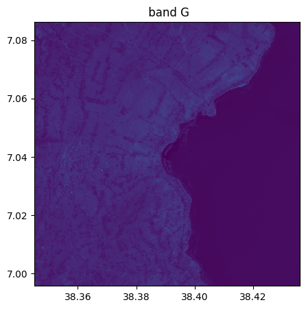
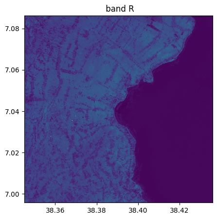
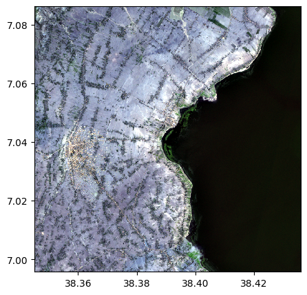
image_recovered=image.image_from_table(table[:,1:4],names={"R":3,"G":2,"B":1})
image_recovered.info()

image_recovered.visu()
image_recovered.colorcomp()
- Size of the image:
   - Rows (height): 1000
   - Cols (width): 1000
   - Bands: 3
- Spatial resolution: 10.0  meters / degree (depending on projection system)
- Central point latitude - longitude coordinates: (7.04099599, 38.39058840)
- Driver: GTiff
- Data type: int16
- Projection system: EPSG:32637
- Nodata: -32768.0

- Given names for spectral bands:
   {'B': 1, 'G': 2, 'R': 3}

Creating a Geoimage from a numpy array (channel_first or channel_last)
We can directly create a geoimage from a numpy array with function upload_image.
bands=["R","B","SWIR1"]
im_np=image.numpy_channel_first(bands=bands)
print(im_np.shape)
(3, 1000, 1000)
# We modify bands
im_np[2,:,:]=im_np[1,:,:]+im_np[0,:,:]
We put the new image with the modified 3 bands in a Geoimage
help(image.upload_image)
Help on method upload_image in module rastereasy:

upload_image(
    image,
    names=None,
    dest_name=None,
    channel_first=True,
    inplace=False
) method of rastereasy.Geoimage instance
           Update the image data with a new image array.

           This method replaces the current image data with a new image array. The new image
           must have compatible dimensions with the current image.

           Parameters
           ----------
           image : numpy.ndarray
               The new image data to upload, with shape:
               - (bands, rows, cols) if channel_first=True
               - (rows, cols, bands) if channel_first=False
               - (rows, cols) for a single band
           names : dict, optional
               Dictionary mapping band names to band indices. If None, bands will be named
    sequentially ("1", "2", "3", ...).
               Default is None.
           dest_name : str, optional
               Path to save the updated image. If None, the image is not saved.
               Default is None.
           channel_first : bool, optional
               Whether the input image has channels in the first dimension (True) or the last
               dimension (False).
               Default is True.
           inplace : bool, default False
               If False, return a copy. Otherwise, upload image in place and return None.

           Returns
           -------
           Geoimage
               The updated image or None if `inplace=True`

           Raises
           ------
           ValueError
               If the spatial dimensions of the new image don't match the original image

           Examples
           --------
           Examples
           --------
           >>> # Create a new filtered image without modifying the original
           >>> array = image.numpy_channel_first()
           >>> filtered = apply_some_filter(array)  # Apply some processing
           >>> filtered_image = image.upload_image(filtered)
           >>> filtered_image.visu()
           >>> image.visu()  # Original remains unchanged
           >>>
           >>> # Create a single-band image from NDVI calculation
           >>> nir = image.numpy_channel_first(bands=["NIR"])
           >>> red = image.numpy_channel_first(bands=["Red"])
           >>> ndvi = (nir - red) / (nir + red)
           >>> ndvi_image = image.upload_image(ndvi, names={"NDVI": 1},
           >>>                                dest_name="ndvi.tif")
           >>> # Update an image with processed data
           >>> array = image.numpy_channel_first()
           >>> filtered = some_filter_function(array)  # Apply some processing
           >>> image.upload_image(filtered, inplace=True)
           >>> image.visu()
           >>>
           >>> # Upload an image in channel-last format
           >>> import cv2
           >>> bgr = cv2.imread('rgb.jpg')  # OpenCV uses BGR order
           >>> rgb = bgr[:, :, ::-1]  # Convert BGR to RGB
           >>> image.upload_image(rgb, channel_first=False, dest_name="from_jpeg.tif", inplace=True))

           Notes
           -----
           The spatial dimensions (rows, cols)
           must match the original image, but the number of bands can change.
image_modified=image.upload_image(im_np)
image_modified.info()
- Size of the image:
   - Rows (height): 1000
   - Cols (width): 1000
   - Bands: 3
- Spatial resolution: 10.0  meters / degree (depending on projection system)
- Central point latitude - longitude coordinates: (7.04099599, 38.39058840)
- Driver: GTiff
- Data type: int16
- Projection system: EPSG:32637
- Nodata: -32768.0

- Given names for spectral bands:
   {'1': 1, '2': 2, '3': 3}
image.info()
- Size of the image:
   - Rows (height): 1000
   - Cols (width): 1000
   - Bands: 12
- Spatial resolution: 10.0  meters / degree (depending on projection system)
- Central point latitude - longitude coordinates: (7.04099599, 38.39058840)
- Driver: GTiff
- Data type: int16
- Projection system: EPSG:32637
- Nodata: -32768.0

- Given names for spectral bands:
   {'CO': 1, 'B': 2, 'G': 3, 'R': 4, 'RE1': 5, 'RE2': 6, 'RE3': 7, 'NIR': 8, 'WA': 9, 'SWIR1': 10, 'SWIR2': 11, 'SWIR3': 12}